The Chemin du Roy between Quebec City and Montreal
par Morissonneau, Christian
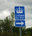
Today the Chemin du Roy, or King’s Highway, is a well known heritage route. Motorists along the north bank of the St. Lawrence River between Quebec City and Montreal can take Highway 138, which follows the approximate path of the original King’s Highway. Along the Chemin du Roy tourist route, blue signs guide drivers from town to village among the region’s heritage buildings and landscapes. Avenue Royale—which is a continuation of the original Chemin du Roy east of Quebec City—is yet a further occasion to visit and take in several additional heritage treasures. But the original King’s Highway, which was the first road to link Quebec City with Montreal was built in 1734. Along its winding course one can discover a condensed history of transportation in the St. Lawrence Valley.
Article disponible en français : Le chemin du Roy, entre Québec et Montréal
An Almost Forgotten Tale
One of the most significant contemporary events involving the Chemin du Roy took place during Charles de Gaulle’s official visit to the Province of Quebec as a part of his visit to Canada. The President of the French Republic enthusiastically decided to take the highway—a symbol of New France, as well as France’s former glory days—as he travelled from Quebec City to Montreal on his way to the World Fair in July of 1967. People remember his famous words “Vive le Québec libre” uttered from the balcony of Montreal’s City Hall much more than his trip down the King’s Highway, which at the time was considered to be quite the event. But his choice of the road does underline the importance of this unique pioneer road, of which much has faded from the people’s collective memory. Although commemorative plaques acknowledge the history and heritage of the route, few seem to know the real story behind Quebec’s very own King’s Highway.
A Long Awaited Intercity Route
In New France there were three types of roads: mill roads (that censitares [seigneurial land tenants] used to go take their grain to be ground into flour), connecting roads (the lanes that connected range roads where farmers lived), and finally, the main highways (known as the Royal Routes). The road maintenance was a mandatory community chore and keeping up the road system was a burden fully born by the people, usually under the supervision of a captain of the local militia who took his orders from the local parish priest or a lord (who had the responsibility of building and maintaining it). Each citizen was responsible for the maintenance of the section of road in front of his land. This is probably why it was a long time before a road through the entire breadth and length of New France was created. A hundred years after the French had settled the region the only land roads in use resembled trails more than roads (with the exception of the St. Lawrence River, which was the main transportation route inland from the sea). These rough trails were mostly dirt tracks connecting the various communities in populated areas. They didn’t however connect the various seigneurial estates together. The roads are were laid out along a route that was two “perches” (12 metres) above flooded lands and the highest waterline. Official mail was transported by boat on the St. Lawrence or, when possible, by messengers on horseback traveling on what could barely be called trails.
On February 1, 1706, the Conseil Supérieur of New France decided to undertake the building of main routes for the colony, including the Chemin du Roy, which would connect Quebec City with Montreal. At that time, 14 of the 37 seigneurial estates that were located between the two cities had only a few existing sections of road, which would need to be improved and lengthened to connect to the future King’s Highway. Pierre Robineau de Becancour, the colony’s chief road surveyor from 1699 to 1729, largely deserves the credit for having drawn up the plans for the layout of the King’s Highway between Quebec City and Montreal. It was however his successor, Jean Eustache Lanouiller Boiscler, who took matters in hand in the summer of 1732. The new chief road surveyor went out and surveyed the path the highway would take, marked off the route for the thoroughfare and then met with the militia captains.
Steward Gilles Hocquart spoke of the surprising effectiveness of Lanouiller de Boiscler’s work when he wrote, in 1734: “Last august, I rode in a two-wheeled, horse drawn chaise and it took me four and a half days to get to Quebec City from Montreal.” Three years later, he wrote that “the roads can now accommodate wagons and carriages between Quebec City and Montreal.” The construction of what was then the longest road in North America was thus completed. With its prescribed width of 7.7 meters [24 French feet, 25.3 Imperial feet] it ran approximately 250 kilometres [155.3 miles], more or less along the banks of the St. Lawrence River where the population had settled. It took four to six days to make the trip between Quebec City and Montreal.
Crossing Obstacles: Streams and Rivers
The ferries, barges and canoes used to cross the streams and rivers were subject to the same rules as the road itself. In 1732, Lanouiller said that “Canoes and ropes will be made and provided by the public.” In other words, the people who dwelt along or near these streams had to furnish travellers with the means to cross over. In the 18th century, there were no bridges over most rivers, neither those as wide as the Jacques-Cartier, the Saint-Maurice or the Prairies, nor even over narrower streams such as the Sainte-Anne or the Maskinongé. And the region abounded in rivers! Crossing fares varied depending on the cargo of the ferries: carriages, horses, cattle or simple passengers.
Despite the many easy water routes available, the main land route between the two main population centres was established relatively early in the colony’s history. In the United States, it wouldn’t be until a century later that a similar route would be built through the Appalachians from Cumberland, Maryland, to Wheeling, Ohio!
Public and Postal Transport in the St. Lawrence Valley
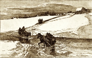
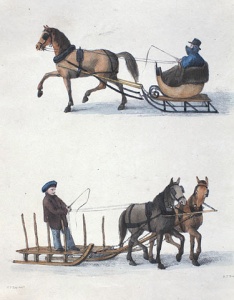
On the Chemin du Roy, the postal carriage—otherwise commonly known as a chaise—was an open two-wheeled vehicle used for public transportation. In the wintertime, the sleigh (sort of carriage mounted on runners that slid over the snow and ice) was used instead. In the 1750s, these vehicles were the mode of transportation used by most travelers.
With the highway in place, a overland public transportation system could then be set up. Thus, postal relays or stages (postal or stagecoach stops) were set up approximately every fifteen kilometres [9.3 miles], wherever there was a semblance of a village. Each stop was run by a postmaster whose duty was to ensure transportation to the next stop. During the winter, with the St. Lawrence frozen over, temporary waypoints were established on the ice. In the 1750s, Louis Antoine, Comte de Bougainville notes his surprise at the lack of inns along the road; for, at the time, travelers stopped to rest and eat in the farmer’s houses. After the British conquest of 1759 (the end of the French and Indian War), 24 to 29 relays (stages) had been established between Quebec City and Montreal.
Organised mail service is essential in a country of vast distances in which the population is sparsely scattered over a broad territory. In the 1760s, it took 30 hours for a horseman to travel the 60 leagues [288 kilometres, 179 miles] separating Montreal and Quebec City to deliver express mail. In 1774, there was a rapidly growing demand for rapid postal courier, and so the frequency of mail delivery was increased to two trips per week. And so, the post would leave Quebec City on Mondays and Thursdays and reach Montreal on Wednesdays and Saturdays. The mail also left Montreal to travel to Quebec City on those same days.
In 1792, the need for proper postal services led to the creation of the Postal Convention (Agreement) between Canada, the United States and England. Messengers on horseback were replaced by mail coaches, chaise, or sleigh (depending on the season), in order to the transport mailbags and travelers. In 1799, a mail coach ran once a week between Quebec City and Montreal. Sections of the road were sometimes flooded by the melting winter snows, forcing travelers and drivers to take an alternative route. Thus, between Berthier and Maskinongé, people started to travel on higher ground further inland along the foot of an escarpment. The route ran along the edge of a terrace that was the remnant of the past shoreline of the St. Lawrence, rather than along the river. The rang York [range route] was thus chosen over the “waterfront route”. People used the “higher road” between Yamachiche, and Rivière-du-Loup en Haut (today’s Louiseville) and Maskinongé for similar reasons: to avoid the floodplain. Today, the tourist route of the Chemin du Roy diverges from Highway 138 in order to follow this more “protected” route.
In the late 1790s, British traveler Isaac Weld spoke highly of Canada’s chaise transport which he preferred over the American stagecoaches. “In all of North America, there is no road as convenient and as well maintained than the one that runs from Quebec City to Montreal. Stops are established at set distances and there, depending on the season, horses, chaises, and sleighs seem to be awaiting travelers.” In 1799, land surveyors determined that the length of the road was 75 leagues and a quarter [381.2 kilometres, 224.4 miles]. There were 29 relays and it crossed seven rivers. The trip cost $16.45 for transportation and 9 shillings and 2 pence for crossings. Thus, from Lafontaine, in D’Autray, to Robillard, in Lavaltrie, the 3.5-league [16.8-kilometer, 10.4-mile] trip cost 2 shillings and 6 pence.
The Golden Age of the Quebec City-Montreal Stagecoach
During the early 19th century the first Canadian stagecoaches began to be used. On January 21, 1811, Josiah Stiles of Quebec City launched the first private stagecoach line. English speakers call the first public transportation vehicles that are not stagecoaches. These are closed four-wheeled horse-drawn vehicles (which use runners in wintertime). In 1814, one could read “[Fr. diligence] carriage commonly known as stage line.” Throughout the 19th century, people used the word stage as much as the French word diligence, which are carriages that stop in way stations. The term mail coach [fr: malle-poste], a stagecoach used for transporting mail, was much less common, even though the stagecoaches were used to carry both mail and passengers a could truly be considered mail coaches as well!
In the wintertime, travelers had a choice between the mail coach and the stagecoach. By stagecoach, a trip from Quebec City to Montreal could take two days. An advertisement dating from 1851, owners of a stage line mention that the trip with their service took only two days on the established a stage line, with stagecoaches leaving daily from Montreal and Quebec City except on Sundays. The stagecoach left at five in the morning and stopped in Trois-Rivières for the night. A great number of travelers preferred the mail coach for its speed; for it did not stop for the night in Trois-Rivières, but rather, stopped at every way station along the route. The trip could be made in 34 to 36 hours, if travelers did not stop for the night in Trois-Rivières. Moreover, the rates of the mail coach were lower.
A New Means of Transportation
Stagecoaches, which were more comfortable than the chaises, were more popular with travelers. They were so much more in demand that, starting in the 1810s, people progressively stopped using the chaises. Around the same time a new type of transportation started to compete with the land-based means of transportation: the steamboat. Thereafter, the boats would operate on the St. Lawrence River in the summertime. However, in the long run, there was no real competition between the river boats and the coaches, since traveling by land was much quicker that traveling on the river and the boats were not able to operate in the winter. The mail coach primarily transported the mail first and then sometimes travellers. The summer stagecoaches were faster than the winter sleighs and covered the 288 kilometres [179 miles] of the King’s Road between Montreal and Quebec City in around 36 hours, which is around eight kilometres [five miles] an hour.
During the golden era of the stagecoach (which extended from the 1810s to the 1850s), the number of way stations was reduced to ten: Ancienne-Lorette, Cap-Santé, Deschambault, Sainte-Anne, Trois-Rivières, Yamachiche, Maskinongé, Berthier, Lavaltrie and Bout-de-l'Ile. People called them “stage houses” or “postal stations”. At the time, two main stagecoach companies were engaged in fierce competition. Each one painted its vehicles in livery that was a different colour from the other. Samuel Hough had the red line, which was considered as the line for the English-speaking colonists, and Michel Gauvin had the green line which was viewed as the line for the French-speaking colonists, otherwise known as Canadiens. The vehicles crossed paths in the evening, at dinnertime in Trois-Rivières. No more than a half hour was given for breakfast and lunch apiece. In 1833, Gauvin used 15 stagecoaches in summertime and 24 sleighs in the winter. During the winter of 1836-1837, an average of 4.2 people travelled each day on the Quebec City-Montreal stagecoaches along the section of the route that went from Lavaltrie to Bout-de-l’Ile near Montreal and an average of 2.7 people travelled in the opposite direction. The two rival companies merged in 1844 and began to run only one stagecoach line during the winter.
In Montreal, the vehicles left from the Leblanc Hotel located in a square known as Place de la Douane. Just as before the merger, the trip took two days, which included a night stop in Trois-Rivières. There were two major stops for lunch, which also must be mentioned: Deschambault, located halfway between Trois-Rivières and Quebec City, and Berthier, halfway between Montreal and Trois-Rivières. The song “Sur la Route de Berthier” is reminiscent of the route taken during stage coach days. In the 1830s, at this village where ships traveling on the St. Lawrence also docked (in the North Channel which was the deepest) there were around twenty inns lining the thoroughfare. A bit of information on how the coaches were pulled: the horses that once pulled the vehicles were Canadian Horses. Isaac Weld wrote of their small size, of their stamina, and of their speed. Thus, the stagecoaches were pulled by teams of four horses while the sleighs were pulled by only two horses, with one in front of the other.
After the mid 19th century, most people used the steamboats to travel during summer. This put an end to the business of the stagecoach line. Only the mail coach remained, carrying mail and passengers alike all year round. The final blow was struck in 1879, with the inauguration of the railway along the north bank of the river. The steamboats and the railway rendered the horse-drawn public transportation services obsolete. It was only in the 1950s, with the advent of the automobile, that the route would reclaim some of its former glory. It was then that the Chemin du Roy became Main Road Number 2 and eventually Highway 138. In the mid 1960s, Highway 40 was added, section by section.
What Remains of the Chemin du Roy
Two of the original way stations on the Chemin du Roy still remain, one in Deschambault (260 Chemin du Roy) the other in Donnacona (Pointe aux Écureuils, 980 Notre-Dame Street). There still remains sections of the original road which have been “forgotten” or have disappeared for various reasons: frequent flooding (around Yamachiche and Maskinongé), landslides (Lavaltrie and Lanoraie where the churches were rebuilt and the road moved), erosion of the shoreline (Notre-Dame Street in Montreal and Pointe-aux-Trembles) and modification of the original route (chemin du Bord-de-l’Eau, in Saint-Sulpice). The place that resembles the most what the road used to look like during the 18th century, when it was a dirt road, is still a public road. It is the Rang du Fleuve, located between the Rang du Berthelet and the Chicot River. It is 3.5 kilometres [2.2 miles] long with no paving, telephone poles, electric wiring or pole of any kind. It goes through two municipalities: Sainte-Geneviève-de-Berthier and Saint-Cuthbert. Interestingly, a barge was still in use on the Chicot River in the 1940s.
Finally, the Royale Avenue (of which some segments are named “Route de la Nouvelle-France”), located to the east of Quebec City on the north bank of the St. Lawrence River is evocative of the meandering lanes of the country’s former roads. These winding routes were much more sinuous compared to today’s modern roads. Although none would suggest recreating the traveling conditions found on the roads of the 18th and 19th centuries—which were quite uncomfortable compared with today’s standards—the significant role of the Chemin du Roy played in the community’s past deserves acknowledgement. Nonetheless, the historic importance of this road is yet noticeable and commemorated in several locations. Not only is it marked with road signs, which help people find it as they drive along the region’s highways, but several institutions or businesses have been named after it the historic heritage route. For example, there is a family centre, a Mauricie regional school board, as well as a maple grove near Quebec City which bear its name. And so the historic and heritage significance of the old King’s Highway, our Chemin du Roy will remain in the collective memory of the community for a long time to come.
Christian
Morissonneau
Geographer and historian
Bibliography
Bouchette, Joseph (1815), A Topographical description of the province of Lower Canada, with remarks upon Upper Canada and on the relative connexion of both provinces with the United States of America. London, Printed for the author and published by W.Faden.
Franquet, Louis (1889), Voyages et mémoires sur le Canada, Québec, A.Côté, 1889.
Guillet, Edwin Clarence (1967), The Story of Canadian Roads. Toronto, University of Toronto Press.
Lambert, Pierre (1998), Les anciennes diligences du Québec, Sillery, Septentrion.
Morissonneau, Christian (2007), D'escale en escale, Continuité, dossier « Sur le chemin du Roy », 114 : 22-24
Sansfaçon, Roland (1958), La construction du premier chemin Québec-Montréal et le problème des corvées (1706-1737), Revue d'Histoire de l'Amérique française,12 (1) :3-29
Weld, Isaac (1799), Travels through the States of North America and the Province of Upper and Lower Canada during the years 1795,1796 and 1797, London, Stockdale.

Additional DocumentsSome documents require an additional plugin to be consulted
Images
-
 À l'occasion de la vi
site du Général... -
 Auberge Pinard, Bas-C
anada, vers 186... -
 Calèche descendant un
e côte à Québec... -
 Calèche et cheval
-
 Calèche, vers 1848
-
 Calèche, vers 1900-19
10 -
 Carriole attelée, Ont
ario, 1910 -
 Carriole canadienne,
vers 1856
-
 Carte postale montran
t le chemin à l... -
 Carte postale montran
t le chemin du ... -
 Carte postale montran
t une calèche, ... -
 Détail d'une carte de
la Nouvelle-Fr...
-
 Deux hommes en calèc
he sur la rue d... -
 Devis d'un falot de c
haise de poste,... -
 Diligence
-
 Diligence américaine
en 1841. Natur...
-
 Exemple de diligence
de poste frança... -
 Fusion des lignes de
diligence verte... -
 Habitants en carriole
, vers 1856 -
 L'hiver arrive au Qué
bec, vers 1882
-
 La ville de Québec v
ue du fleuve ge... -
 Lancement des Voiture
s vertes entre ... -
 Le facteur rural, ver
s 1900 -
 Les chutes Montmorenc
y en hiver, 180...
-
 Maison d'inspiration
française sur ... -
 Maison sur le chemin
du Roy, 2008 -
 Place d'Armes à Montr
éal, 1848 -
 Place d'Armes, Montre
́al, 1830
-
 Plan d'un quartier de
Montréal en ao... -
 Requête présentée au
grand voyer de ... -
 Scène d'hiver au Cana
da - Traversée ... -
 Scène hivernale au Ca
nada - portage ...
-
 Scènes hivernales au
Québec, c. 1915... -
 Signalisation du chem
in du Roy, 2008 -
 Silhouette d'un group
e en carriole, ... -
 Tandem sur la rue Do
rchester, Montr...
-
 Timbre commémoratif é
voquant l'évolu... -
 Tronçon du chemin du
Roy originel -
 Tronçon du chemin du
Roy originel te... -
 Une carriole avec un
cheval, vers 18...
-
 Une carriole et un t
raîneau de fer... -
 Une carriole vers 184
0 -
 Une carriole, Montré
al, 1882 -
 Une diligence prise d
'assaut

![Sign for the Chemin du Roy [King’s Highway], 2008](/media/thumbs/4984/266x300-chemin_42.jpg)


